Leave Your Message

What Is a UAV Unmanned Aerial Vehicle?

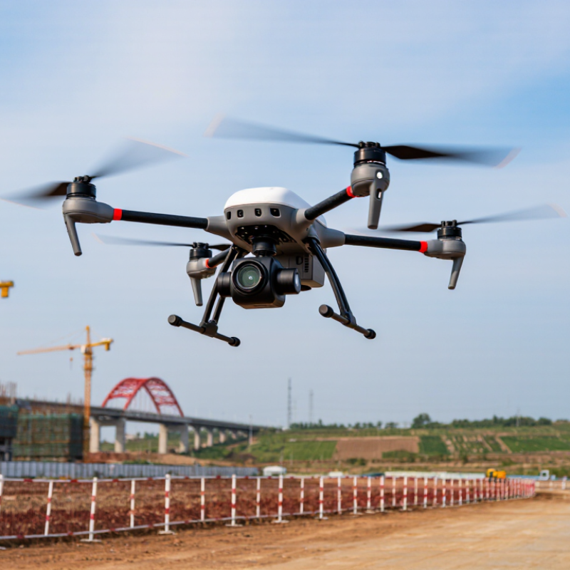
A Uav Unmanned Aerial Vehicle is an aircraft operated without a pilot sitting inside it. It may fly remotely or follow carefully programmed instructions. Small camera drones are familiar examples, but the category includes many specialized systems. Survey teams use them to map construction sites, inspect bridges, and monitor crops. Emergency services may use them to view difficult terrain from a safer distance. Their value comes from reaching places that are costly, dangerous, or slow to access on foot.

Understanding these aircraft requires more than recognizing a flying camera. A UAV combines airframe design, motors, batteries, sensors, communication links, and flight-control software. During practical operations, weather, signal strength, battery condition, and surrounding obstacles can change quickly. A responsible operator checks the equipment before flight and records relevant observations afterward. Reliable work also depends on accurate data, trained personnel, and compliance with local aviation and privacy requirements. Rules differ between countries and may change over time.

The terminology can feel confusing. That is normal. “UAV,” “drone,” and “unmanned aircraft” often overlap, but their technical and regulatory meanings may differ. No single explanation covers every aircraft perfectly. A thoughtful introduction should acknowledge those limits instead of promising effortless operation. This guide examines how UAVs work, where they are used, and what responsible operation demands. It also considers practical weaknesses, including limited flight time, weather sensitivity, maintenance needs, and imperfect sensor readings. These details matter because dependable results come from careful preparation, verified information, and honest evaluation.
What Is a UAV Unmanned Aerial Vehicle?

Definition and Core Characteristics of a UAV

What Is a UAV Unmanned Aerial Vehicle?

A UAV is an aircraft operated without a pilot sitting onboard. It may fly by remote control, programmed instructions, or limited autonomy. The term covers small quadcopters, fixed-wing survey aircraft, and larger systems used for industrial inspection. A UAV is not automatically autonomous. Human supervision often remains essential.

Its core characteristics begin with controlled flight. A typical system combines propulsion, batteries or fuel, navigation sensors, communication links, and a payload. Cameras, thermal sensors, and mapping equipment turn flight into useful information. During field inspections, operators may watch a live feed while the aircraft follows a planned route beside power lines or above farmland. The Federal Aviation Administration’s 2024 registration data shows the United States has more than one million registered recreational and commercial drones, illustrating the scale of real-world deployment. It is not magic.

UAVs also depend on reliability and operational discipline. A lost communication link, weak battery, or inaccurate positioning can interrupt a mission within seconds. PwC’s global analysis estimated that drone-powered business services could create about 127 billion dollars in value, mainly across infrastructure, transport, agriculture, and logistics. That estimate is influential, but it should not be treated as guaranteed revenue. The gaps matter. Weather, data quality, pilot training, and maintenance still shape performance. In practice, a UAV is best understood as an integrated flying system, not merely a camera attached to a motor.
How Unmanned Aerial Vehicles Operate

What Is a UAV Unmanned Aerial Vehicle?

How Unmanned Aerial Vehicles Operate

A UAV is an aircraft controlled remotely or guided by onboard software. Its operation begins with a flight plan, launch command, and continuous position checks. The ground controller sends instructions through a radio or cellular link. The aircraft responds within milliseconds. Sometimes, the signal weakens. That matters.

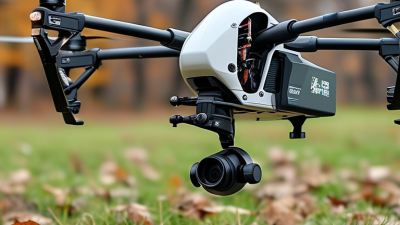
Inside the aircraft, the flight controller acts like a nervous system. Gyroscopes and accelerometers measure movement. Satellite navigation estimates position. Barometers track height, while cameras or radar detect nearby surfaces. Software combines these inputs and adjusts motor speed several times per second. A quadcopter can tilt forward, increase thrust, and follow a programmed route. It is simple in appearance, but not simple in execution.

The FAA’s 2024 registration data reported more than 850,000 registered drones in the United States. This growing fleet increases pressure for dependable identification, maintenance, and pilot training. EASA’s European Drone Incident Reporting guidance also emphasizes communication failures, navigation errors, and human decisions as operational risks. Sensors can drift. Batteries lose capacity in cold air. Operators may trust automation too much. A safer workflow checks weather, battery condition, link quality, and emergency procedures before takeoff. The technology still needs judgment.

What Is a UAV (Unmanned Aerial Vehicle)? — How Unmanned Aerial Vehicles Operate

A UAV is an aircraft that operates without a pilot on board. It uses propulsion, flight-control computers, sensors, navigation systems, and a communications link to perform remotely controlled or autonomous missions.

UAV Configuration How It Generates Lift Takeoff and Landing Typical Flight Endurance Typical Operating Speed Navigation and Control Common Civilian Applications Primary Operating Limitation
Multirotor Several horizontal rotors provide lift and control by changing individual rotor speeds. Usually takes off and lands vertically; it does not require a runway. 20–45 minutes 0–70 km/h Remote control, satellite navigation, inertial sensors, altitude sensors, and automated flight modes. Aerial inspection, mapping small areas, photography, infrastructure surveys, and short-range monitoring. High energy consumption during hovering limits range and endurance.
Fixed-Wing Fixed wings generate aerodynamic lift while a propeller or jet provides forward thrust. Requires a runway, launch device, or assisted launch; landing may use a runway, skid, or recovery system. 1–12 hours 60–180 km/h Autopilot combines navigation data with airspeed, altitude, attitude, and position measurements. Large-area mapping, environmental surveys, agricultural monitoring, and long-distance observation. Cannot normally hover and needs suitable launch and recovery space.
Vertical-Takeoff-and-Landing Hybrid Vertical rotors provide lift during takeoff and landing; fixed wings provide efficient forward flight. Can take off and land vertically, then transition to wing-borne flight. 1–8 hours 50–150 km/h Flight software manages the transition between hovering and forward flight while maintaining stability. Long-range surveying, corridor inspection, coastal observation, and regional mapping. More mechanically and computationally complex than a basic multirotor or fixed-wing UAV.
Single-Rotor A large main rotor generates lift, while a smaller tail rotor or another control system manages yaw. Usually capable of vertical takeoff and landing from a compact area. 1–5 hours 40–160 km/h Flight-control systems regulate rotor thrust, attitude, altitude, and navigation commands. Heavy sensor transport, extended observation, terrain surveys, and specialized aerial operations. Rotor systems are mechanically complex and can require more maintenance and operational skill.
Tethered UAV Rotors generate lift while a physical tether supplies power and may carry data between the aircraft and ground equipment. Vertical takeoff and landing; the aircraft remains connected to a ground station. Several hours to multiple days Usually stationary or low-speed Commands and data travel through the tether, while onboard stabilization systems maintain position. Persistent site monitoring, temporary communications support, event observation, and emergency response. Operating area and altitude are constrained by tether length, weight, wind, and ground equipment.
High-Altitude Long-Endurance UAV Large wings generate lift during efficient forward flight, commonly using low-power propulsion. Requires a runway or specialized launch and recovery procedure. 12 hours to several days 80–250 km/h Uses redundant navigation, autopilot functions, remote command links, and mission-planning software. Atmospheric research, wide-area environmental observation, communications relay, and scientific measurement. Requires advanced systems, favorable operating conditions, and carefully managed airspace access.

Operating principle: During a mission, the ground operator or onboard software defines the flight plan. Sensors measure position, altitude, speed, and orientation; the flight controller compares these measurements with the planned commands and adjusts the motors or control surfaces. A communications link can transmit commands and telemetry, while onboard systems may continue the mission or execute a predefined safety action if the link is interrupted. The ranges shown are typical operational estimates and vary with aircraft mass, payload, battery or fuel capacity, weather, altitude, and mission requirements.

Major Types and Configurations of UAVs

What Is a UAV Unmanned Aerial Vehicle?

Major Types and Configurations of UAVs

UAVs are aircraft operated without an onboard pilot. Their configuration determines endurance, control, payload, and operating limits.

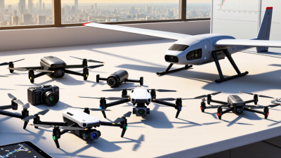
Multirotor UAVs use several vertical propellers. They can hover beside a bridge or inspect a narrow rooftop. Their weakness is limited flight time, often 20 to 45 minutes with practical payloads.

Fixed-wing UAVs resemble small airplanes. They generate lift through forward movement and suit mapping, agriculture, and long corridor surveys. They cannot hover.

Hybrid VTOL UAVs combine vertical takeoff with efficient fixed-wing travel. This flexibility is valuable, but their transition systems add weight and failure points.

The FAA’s 2024 aerospace forecast projects the United States commercial small-UAS fleet could approach 860,000 aircraft by 2028. That growth will not create one universal design. A tethered configuration can support extended observation near a fixed site, while a compact multirotor fits indoor inspection work. Larger platforms may carry multispectral cameras, thermal sensors, or lightweight LiDAR. Payload placement matters. A bottom-mounted sensor may improve visibility, yet it can reduce ground clearance. These categories help, but real missions often overlap. The “best” UAV is rarely obvious.

Tips: Match the aircraft to the mission, not the marketing claim. Record wind, temperature, payload weight, and battery results during field tests. The Drone Industry Insights 2024 market report also emphasizes expanding commercial demand, but market forecasts remain estimates. Treat them as planning evidence, not certainty. Small details matter. A perfect specification sheet can still fail beside a cold, windy hillside.

Common Applications of UAV Technology

Unmanned aerial vehicles, or UAVs, are aircraft operated without a pilot onboard. Their most useful role is practical observation. In agriculture, a UAV can scan dry crop rows, identify uneven growth, and create a field map before workers inspect the ground. The 2024 FAA Aerospace Forecast expects the U.S. commercial small-UAS fleet to keep expanding through 2028. That growth reflects demand for measurable information, not simply excitement about flying machines.

Construction teams use UAVs to record roof conditions, stockpiles, and project progress. Surveyors can capture hundreds of overlapping images, then build a three-dimensional site model. Emergency planners also use thermal cameras to locate heat differences after storms or industrial accidents. According to the Association for Uncrewed Vehicle Systems International’s 2023 Economic Impact Report, the U.S. drone industry could support more than 100,000 jobs and generate over 115 billion dollars in economic impact by 2025. These figures suggest that data services may matter more than the aircraft itself.

Delivery trials and infrastructure inspections receive attention, but they expose practical limits. Batteries remain limited. Wind can blur images. A precise map can still lead to a poor decision. Operators need documented training, maintenance records, secure data handling, and clear flight procedures. The International Civil Aviation Organization continues to emphasize risk-based planning for remotely piloted aircraft. That guidance matters because safe deployment depends on people, not automation alone.

Regulations, Benefits, and Limitations of UAVs

A UAV, or unmanned aerial vehicle, is an aircraft operated without a pilot inside it. It may carry cameras, sensors, or other lawful equipment. Its value depends on responsible operation, not just flight capability.

Regulations vary by country and sometimes by city. Operators may need registration, pilot certification, insurance, or permission for specific airspace. Many authorities require the aircraft to remain within visual line of sight. Flights near airports, emergency scenes, government facilities, or crowded events may face strict limits. Privacy rules also matter. Recording a neighbor’s garden through a window can create serious legal and ethical problems. Requirements can change quickly. Checking official aviation guidance before every operation is a practical habit.

UAVs can inspect roofs, map farmland, monitor forests, and support search teams without exposing workers to unstable areas. A thermal sensor may reveal heat loss on a building before damage becomes visible. Yet benefits come with limitations. Batteries often provide limited flight time, especially in cold or windy weather. Heavy rain can stop a mission. Signal loss, poor navigation, and obstructed views can also interrupt safe control. Data management is another weakness. Detailed aerial images may help a project, but they can also expose personal information. Field teams sometimes focus on the flight and overlook the people below. That mistake deserves more attention.

What Is a UAV Unmanned Aerial Vehicle? – Regulations, Benefits, and Limitations

UAV regulations commonly use maximum take-off mass to determine operating requirements. In the United States, small unmanned aircraft operated under FAA Part 107 must weigh less than 55 lb (25 kg). In the European Union, the open category uses several aircraft classes, ranging from less than 250 g to less than 25 kg. UAVs can improve access, monitoring, mapping, and inspection while still facing limitations related to safety, privacy, weather, battery life, and airspace restrictions.

Sources: U.S. FAA Part 107 and EASA Open Category requirements. Thresholds shown are maximum aircraft mass limits.