


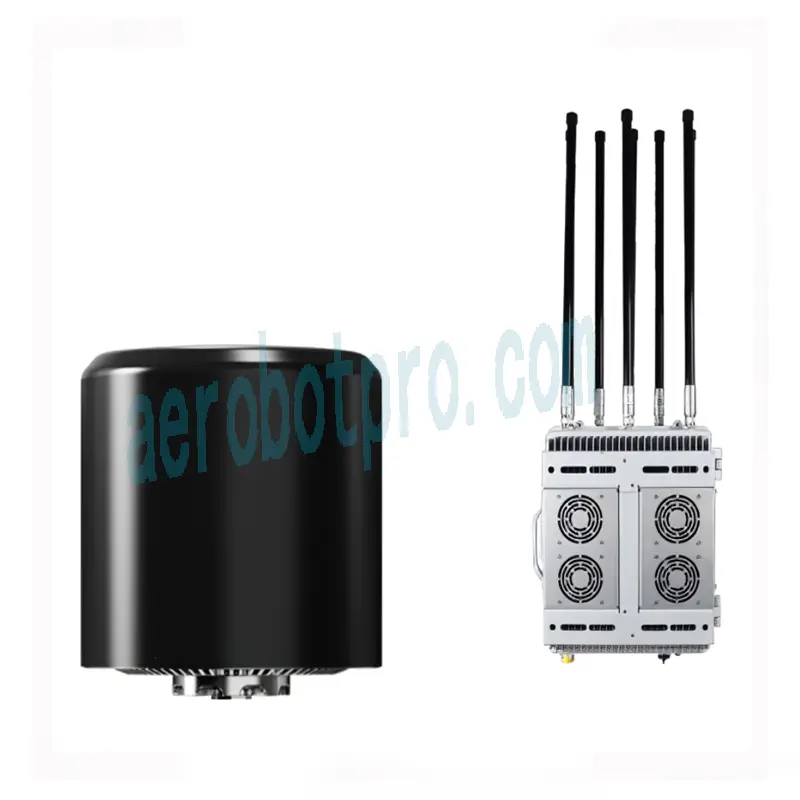
Drone Detector & Jammer & Navigation spoofer integrated equipment
Disclaimer and Warning
The Aero D2Pro System is a comprehensive platform Integrated 3-in-1 Detection and jammer and gps spoofing System that rapidly identifies UAV communication links, gathering information such as flight status, paths, and other information in real-time ("Monitoring Data"). Monitoring Data stream helps users make an informed response as soon as possible. Please note that Monitoring Data does not involve personal data of drone users. (Personal data is any information relating to an identified or identifiable natural person.) Unless pursuant to the requirement or request of any governmental or regulatory agency or court or tribunal of competent jurisdiction to the extent such disclosure is required by any valid laws, regulations, court orders or rules of relevant stock exchange, will not disclose any personal data that collect through Products and Services to third parties.
As a Aero D2Pro's end user, you represent and warrant that you are the eligible user of it. Examples of eligible users would be public safety organizations, law enforcement agencies, government agencies, regulatory bodies, and owners or operators of airports, power plants, and prisons; and you will use the System for monitoring public safety purpose only;and you will comply with any applicable laws concerning the use of t he System within the jurisdiction of operation; and you are solely responsible for the conductsof anyone that use the System through your account, which may include your employees, consultants or contractors, or the employees, consultants or contractors of your affiliates, which are companies or entities that you own, that own you, or that have the same owner or corporate parent as you.
You acknowledge and agree that do not help you comply with any laws, rules, or regulations that may apply to your use of Aero D2Pro, which is solely your responsibility; and shall not be liable for the authenticity of you; and will not be liable for any loss or damage you may cause; and you will defend, indemnify, and hold harmless, its affiliates, and it’s or their directors, officers, employees, agents, shareholders, successors and assigns from and against all claims, losses, damages, penalties, liability, and cost, including reasonable legal fees, of any kind or nature that are incurred in connection with or arising out of a third-party claim relating to, or arising from your breach of Purpose.
Function Descriptions
2.1 Basic
| Function | Descriptions |
| UAV detection | Detection spectrum bandwidth: 70 MHZ - 6GHZ, detection focus on the 433Mhz、868Mhz、915Mhz、2.4Ghz、5.2Ghz、5.8Ghz FPV Detection:300Mhz-6.2Ghz Analog Signal of FPV Drones Simultaneous screening number of UAV: ≧150pcs The lowest detection height: ≤0 meters Detection rate: ≧99.99 %s |
| Drones Location | For UAVs with Remote ID (China GB42590-2023, US ASTM F3411-22a, EU ASD-STAN PrEN4709-002) and Drone ID (such as DJI Mavic2, Mavic3, air3s, Matrice4, etc., some require network decryption), it can parse detailed information such as drone location and pilot location. |
| White and Blacklist | The Systemcan identify ≧ 400 different model UAV including DJI series drones,and it has the autonomous learning ability. The Systemcan carry on the accurate identification of target, in-depth analysis of UAV signal, the identification of unique ID, and the black and whitelist to distinguish. Whitelist and a blacklist can be set for different targets of the same position, same frequency band, same manufacturer, same type of UAV respectively. |
| Defensive Interference | The Systemhas interference capabilities of 900MHz,1.2Ghz; 1.5Ghz, 2.4Ghz, 5.8Ghz; 5.2Ghz and other customized frequency bands, and covers most of the UAV communication available in market. |
| GPS Spoofer | Supports GPS, BDS, GLONASS, Galileo navigation satellite signal simulation, with 6 signal output frequency bands and channel numbers. |
| Remote OAM | After turning on the fully self-movable defense, it can enter unattended mode, detect, and strike autonomously. And a variety of OAM features are available when used with the remote server, including firmware updating, resetting, status inquiry, self-testing, parameter configuration, and more. |
| GPS | The Systemcan detect its current position using its built-in GPS. |
| Networking | The Systemcan network multiple devices through the cloud server, observe the online/abnormal status of each device, and control the device remotely through the mobile terminal (mobile phone IPAD), including but not limited to viewing the operating interface of the device system, receiving alarm information, viewing the black and whitelist, and turning on defense functions. |
| Data security | Use certificate management and data encryption between the equipment and server to ensure data reliability and security. |
2.2 Specs
1. Detection range: In an interference-free environment, signal reception range maybe vary when different antennas are used. the range of detection can up to 10km.
2. Detection spectrum bandwidth: 70 MHZ - 6GHZ, focus on the 433Mhz、868Mhz、915Mhz、2.4Ghz、5.2Ghz、5.8Ghz;
3. FPV Detection:300Mhz-6.2Ghz Analog Signal of FPV Drones,range up to 1-3km
4. Drones Location:For UAVs with Remote ID (China GB42590-2023, US ASTM F3411-22a, EU ASD-STAN PrEN4709-002) and Drone ID (such as DJI Mavic2, Mavic3, air3s, Matrice4, etc., some require network decryption), it can parse detailed information such as drone location and pilot location up to 3-5km.
5. Identify Range: LightBridgel, LightBridge2, Ocusync 1、2、3、4, WIFI and WIFI variant protocols, Zigbee, Bluetooth and other customized protocal of small brand, can identify UAV brands and models;
6. The trajectory: have the function for tracking flight trajectory.
7. Accurate recognition: it can accurately identify UAV model and electronic fingerprints (ID),≧ 400 different uavs models and the corresponding ID (identity) can be identify at the same time.
8. Detection Angle: 360 °
9. Detection number of UAV : ≧150pcs
10. The lowest detection height: ≤0 meters
11. Detection rate: ≧99.9%
12. Broadband Jamming: 800-900Mhz\1.2Ghz\1.5 GHz\2.4 GHz\5.1-5.2GHz\5.8GHz
13. support at the level of effective interception Angle range in a straight line dive and turned to flight of UAV, intercept distance: 2km;
14. System supports GPS, BDS, GLONASS, Galileo navigation satellite signal simulation, with the following signal output frequency bands and channel numbers: BDS B1I、GPS L1 C/A、GPS L2、GPS L5、GLONASS L1、GALILEO E1
15. Maximum GPS spoofer transmission power: ≥20w;
16. Maximum spoofing distance:3km
17. Gps spoofer Power on start-up time: 40s;
18. System power supply mode: 220 V±10V
19. System Protection grade: ≧IP65
20. System Working temperature: - 40 ℃ ~ + 55 ℃
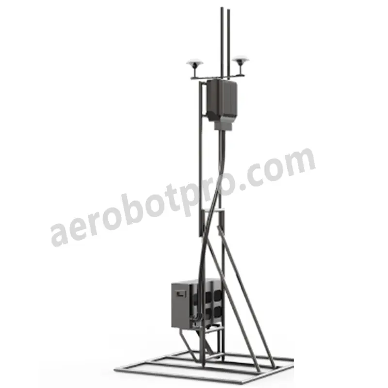
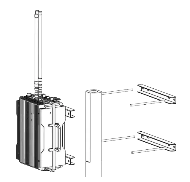
Installation
3.1 Installation Notice
For better founction, it’s recommended that the system should be installed as high as possible on one building or some high place, in an environment free from radio interference, In an open place without physical shelter.
3.2 Lightning Protection
If System is not under System stationary unit system includes surge protection modules in the antenna module, power module, and Ethernet port. The Systemdoes not include a lightning induction system. It should be installed within the protected region of another lightning induction system. The protected region is calculated using the rolling sphere method.
The protection of the nearest lightning rod, a designated lightning induction system should be designed by a qualified professional.
Finally, be sure to note the following:
• Ensure that rainwater cannot flow along the Antenna cable into the D2pro.
• lf the pole is made of metal; the frame and the pole should be separated using insulation.
• Indoor power outlets must have surge protection.
• Indoor Ethernet outlets must have surge protection.
3.3 Power Supply
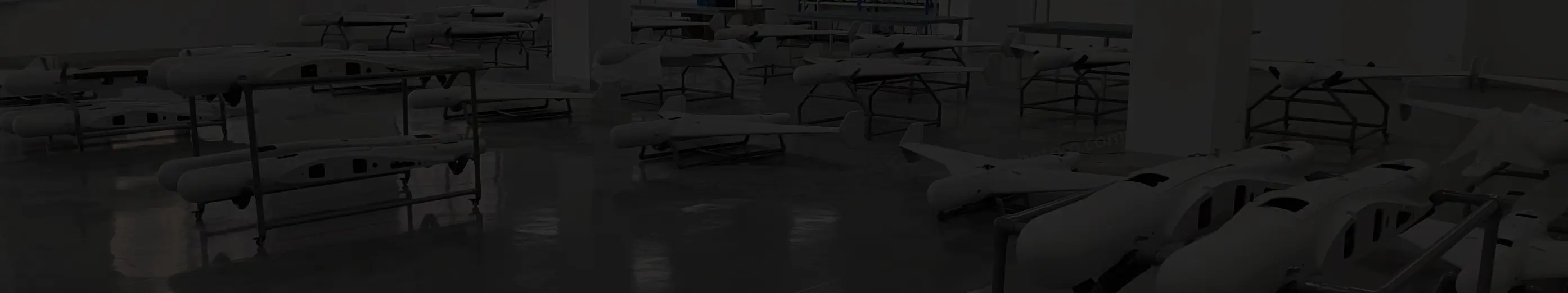
The System is designed to operate at 200~240 V, 50/60Hz, 2.5A Max and 50W in detection mode, 200~240 V, 50/60Hz, 2.5A Max and 500W in Jammer mode, The SystemPower Cable is used to connect the The System stationary unit to a power supply. In addition, it can also use DC power if necessary.3.3 Detector Set Interface
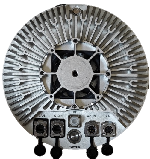
Below the device, there are a total of five interfaces, each corresponding to:
• LAN Port: Used for local area network (LAN) connection; by default, we insert the network cable into this port.
• WAN Port: Used for accessing the cloud server. Connection to this port must be made through the company's internal network and is not recommended for general use.
• RF: Used for debugging the device by our team. You don't need to use this port.
• AC IN: Power port: Please insert the power cord into this port.
• JAM: Used for connecting the jamming device. Once connected to the jamming box, you can jamming the drones.
• The Power button is the power on/off switch.
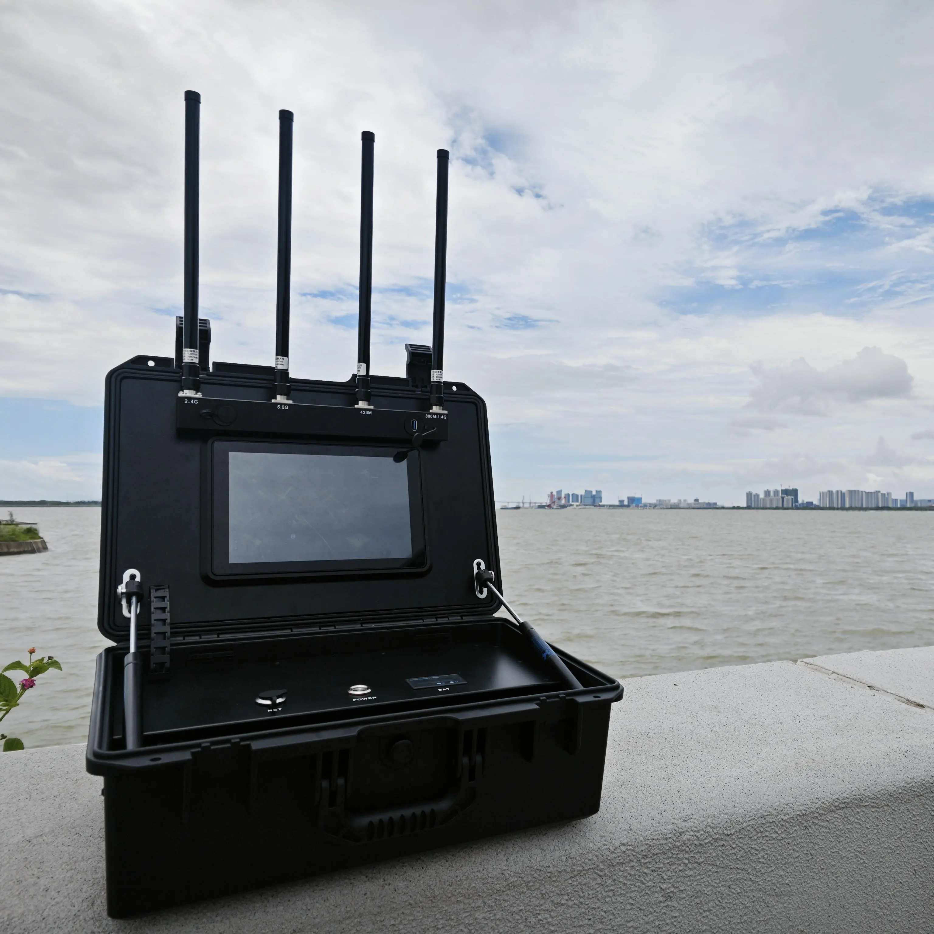
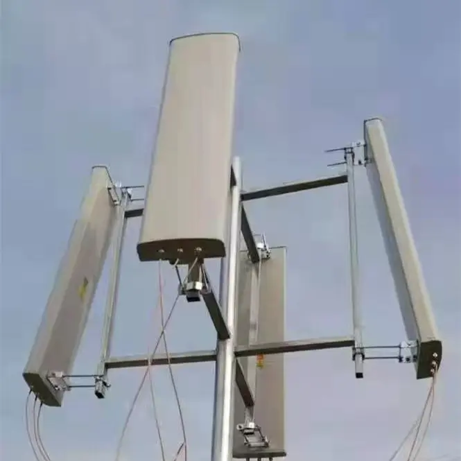
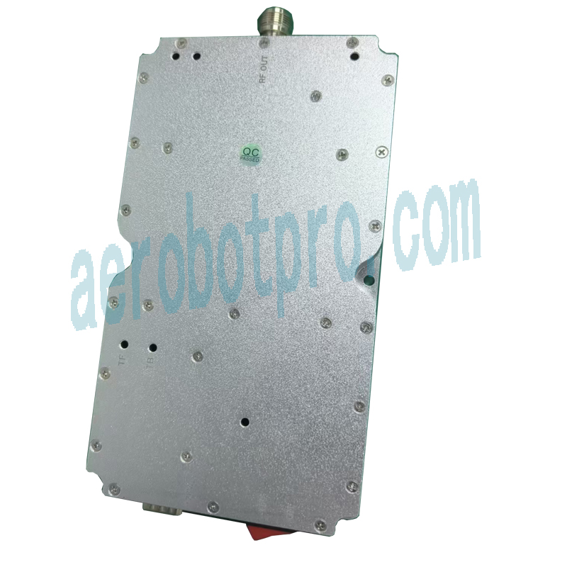
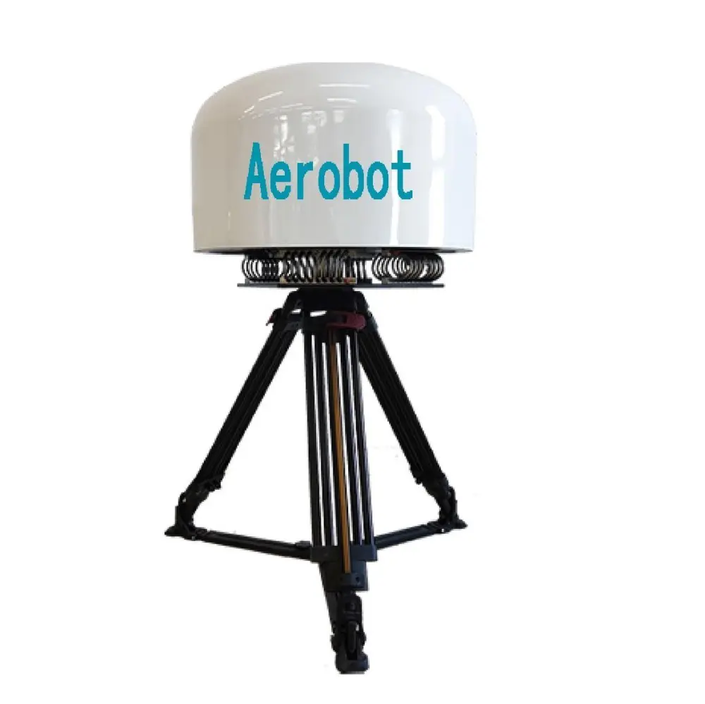
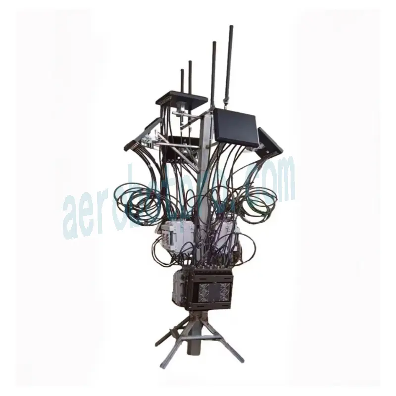
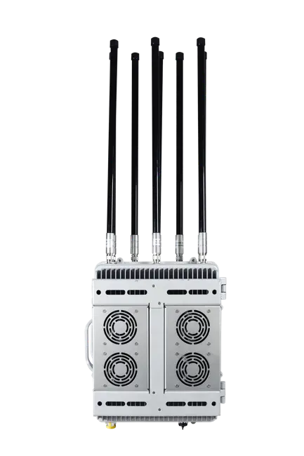
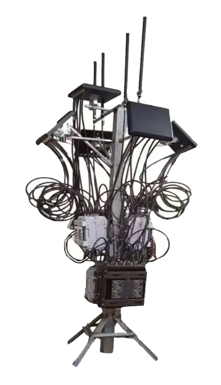
3.4 Jammer & Navigation Spoofer Parts
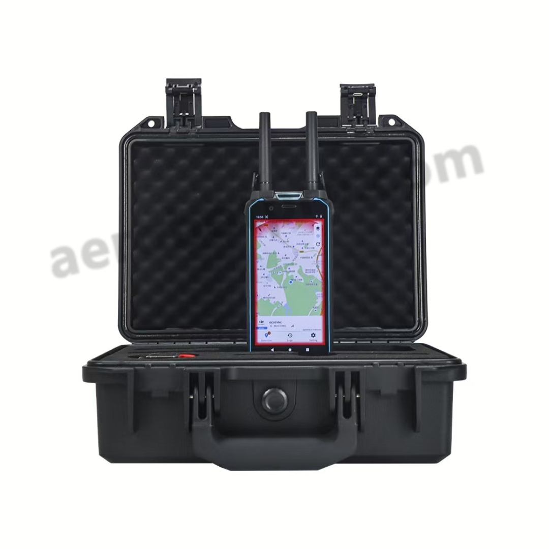
Management Platform
4.1 system initialization
Please enter the login URL on your computer browser: http://169.254.1.1:8081 ,
Then, enter your account and password on the website:
Magament Acount:
• websuper : websuper
• code:********
Normal Acount:
• Account:webuser
• Password(default):********

If you are unable to log in, please be patient for 2-3 minutes and checking your network cable is plugged into the “LAN port”
4.2 UAV Detection
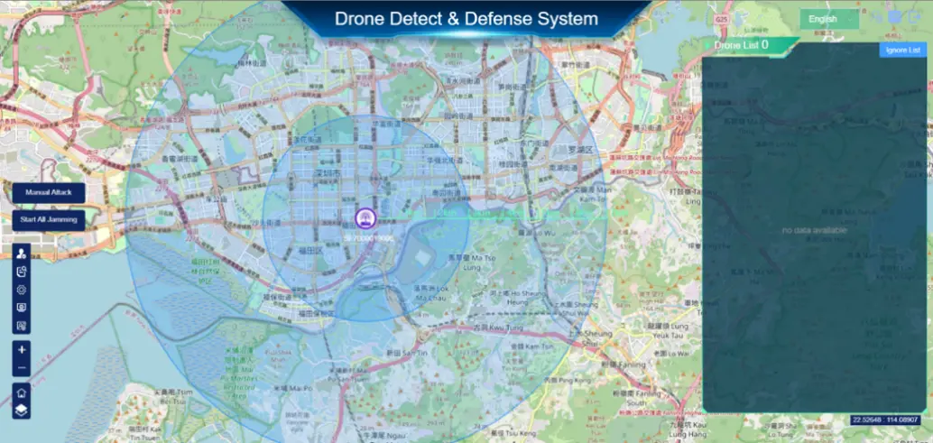
When the device detects a drone, it will emit an alert sound and display information about nearby drones on the system page.
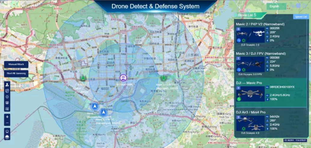
Two places will show drones:
• on the map
• Detection listings
Detection introduction including following information:
• Frequency bands in which the drones operate.
• Model of the drone
•· Approximate orientation angle of the drone
When the signal is strong enough, the device recognizes the drone's GPS signal and displays it on the Drone List.
• Coordinates of the target drone
• The exact angle of the drone
• Unique identification number for drones
• Distance of the drone from the device
•· Frequency bands in which drones operate
Explanation of some of the icons on the map:
• Indicates detection signal changes;
• Indicates that it has been added to the whitelist,
• Indicates that it has not been added to the whitelist;
• Indicates precise strike,
• Indicates that the drone supports precision strikes. No icon indicates that the drone does not support precision strikes;
• Indicates that the drone supports adding to the ignore list. No icon indicates that the drone does not support joining the ignore list.
The map will update the location, trajectory and status of the drone in real time, and is linked to the drone list. When you click on the drone icon, the drone will be selected in the list. When an item in the list is selected, the drone will appear on the map.
• Represents a drone detection target
• Represents the location target (drone has gps location),
• Represents a fuzzy target,
• Indicates that they belong to the white list target (white list)
4.3 Functional module:
4.3.1 User Manage
Click this bottom to enter System Settings.
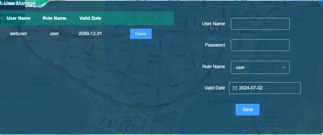
Add user: you can add a new login account and password, giving the corresponding authority level. Among them, super is the highest privilege, admin is the administrator privilege, user is an ordinary user, can only view, can not be operated. Users can change permissions according to their own needs.
Delete User: You can delete a user by clicking the DELETE button in the list.
4.3.2 System Status
Click this bottom to enter System Settings.
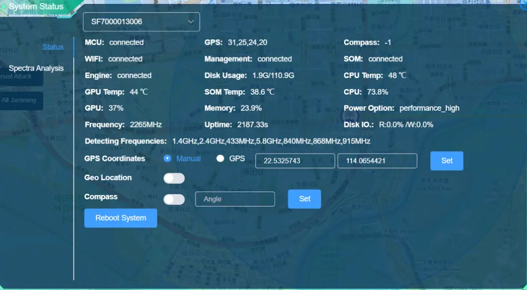
System status includes status information such as MCU, GPS, Compass, WIFI, Management, SOM, Engine, CPU temperature, GPU temperature, SOM temperature, disk space, detection frequency, etc. of the built-in device.

Geo Location: Switching to the blue state means enabling this function, which can analyze the location, but will lose the detection of some models; switching to the gray state means disabling this function, which can enhance the sensitivity of detecting other models, but cannot analyze the location.
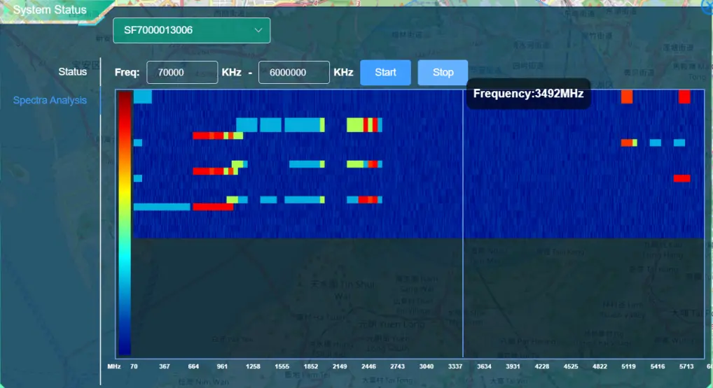
Spectra Analysis mode is used to analyze the surrounding environment, the device through an independent algorithm should be surrounded by the spectrum of signals.
4.3.3 Query Report
Click this bottom to enter Query Report
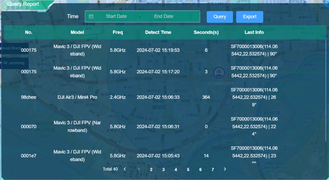
In the report, you can see the detection count of the device, review each entry, and access data analysis charts. Similarly, you can also view the number of drone defense instances.
4.3.4 System Settings
Click this bottom to enter System Settings.
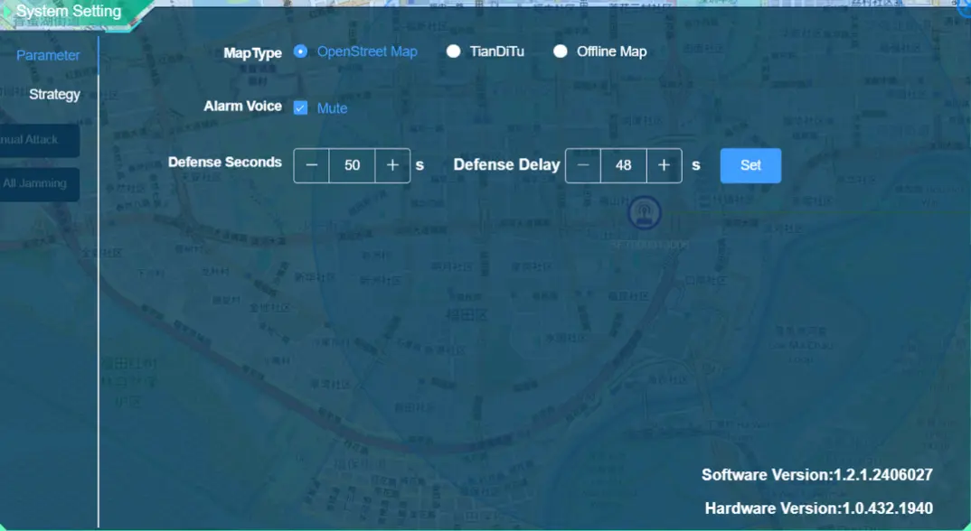
In this mode, you can switch the map type and adjust the alarm sound on/off.
4.3.5 User Config:
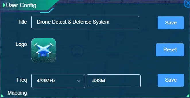
Click on the top right corner button to open the user configuration interface, where you can modify the system title and logo. Click the "Reset" button to reset the title and logo to the default values. By selecting the Freq item, change the Freq display value, and click the "Save" button to pop up a prompt whether to restart the device. Generally, the device is restarted after all changes are completed.
4.3.6 Jamming mode
Click on the device icon on the map to enter strike mode
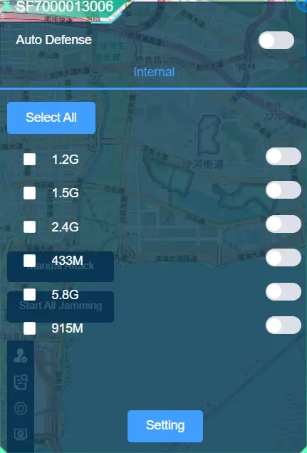
The jamming mode includes can supported jamming frequency bands, and you can freely choose and combine them. You can also enable the Auto Defense function (unmanned guard) here.
4.3.7 Spoofing mode
Click on the device icon on the map to enter spoofing mode
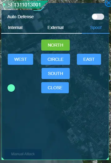
The linear movement, circular movement, and close control buttons in the east, south, west, and north directions are listed. The blue button status is the default. If the working mode is set, click the button, which means that it is set and opened. At this time, the button is in green status. If the current mode needs to be closed, click the close button; The round light indicates the switch status, green indicates on, and red indicates off.
4.3.7 WHITE LIST
Click this bottom to enter white list.
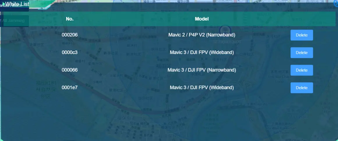
You can add your own drone to the whitelist so that devices won't warn you about your device. The whitelist list mainly shows the drone number and model, and you can delete the whitelist in the list by clicking the Delete button in the list.
Packing List
Box 1:
• The SystemDetection part x 1
• Tripod x 1
• Power cable x 1
• Net cable x 1
• Data connection cable x 1
Box 2:
• The Jamming System x 1
• Jamming antenna x 6pcs
• Power cable x 1
• Jammer Mounting Screws pack x 1
Warranty and Service
1. We promise to ensure that the products provided are brand new and meet the factory standards. Its quality and specifications comply with the technical performance indicators of the product.
2. Warranty period: From the date of product delivery, we provide 1-year free hardware maintenance guarantee service. Damage caused by improper use and storage is excluded.
3. The product should be used in accordance with the original manufacturer’s use requirements, strictly in accordance with the product use requirements and relevant laws and regulations. If the product cannot be used normally due to illegal use or storage, poor maintenance, etc., the applicable room shall bear the relevant consequences.
4. Warranty scope: If there is a quality problem with this product, it needs to be sent back to the country for repair work or to the location designated for repair. During the warranty period, the purchaser shall pay for the round-trip international logistics costs of the equipment.
5. Regularly check whether the antenna and antenna interface connection is normal. When the device is running for a long time, restart the device once month.
6. For the interface that is not in use temporarily, please use the supporting equipment .
7. Regularly remove dust; Recommended storage environment for the device: normal temperature, dry environment.
FAQ
1. Q: Logged-in users are forced to log out of the system.
u A: The software license of the system is invalid, please contact our after-sales personnel to re-register the software license.
2. Q: Cannot detect.
u A: Log in with an account with superuser privileges.
3. Q: Device won't boot
u A: Check that the power cord is properly installed.
4. Q: unable to access normally.
u A: Check whether the network connection is normal.
5. Q: The device can not be located automatically.
u A: Check whether the GPS antenna is properly installed.
6. Q: Poor detection.
u A: Check whether the antenna is properly installed or not installed correctly.
u Choose an environment with less electromagnetic interference as much as possible. If there are metal buildings, shelters, and places with complex electromagnetic environments around the test, it will cause the detection distance to be too short or lost. It is recommended to find a clear and clean environment for testing; it is best to choose the highest point in urban areas to obtain the maximum coverage. Please follow the professional guidance of our company or partners.