Exploring Innovative Alternatives to Drone Surveying in Modern Land Assessment
As the demand for accurate and efficient land assessment continues to rise, the surveying industry is increasingly turning to technology-driven solutions.
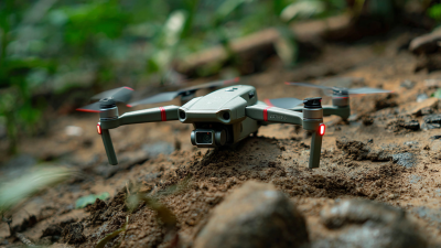
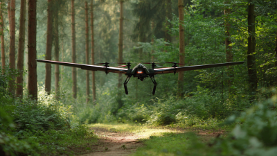
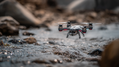
Drone Surveying, a method that offers rapid data collection and high-resolution imagery, has revolutionized traditional surveying practices.
According to a report by MarketsandMarkets, the global drone services market is projected to reach
$63.6 billion by 2025, reflecting a significant shift towards aerial surveying methods.
However, with the emergence of innovative alternatives such as LiDAR, terrestrial surveying, and satellite imagery, there is an exciting opportunity to explore complementary and even superior techniques to enhance land assessment processes.
This blog delves into these alternatives, evaluating their potential to not only match but exceed the capabilities of Drone Surveying, thereby shaping the future of land assessment in an ever-evolving technological landscape.

Innovative Ground-Based Surveying Techniques: Redefining Land Assessment Practices
Innovative ground-based surveying techniques are rapidly redefining land assessment practices, complementing traditional methodologies and offering enhanced accuracy and efficiency. Recent studies have showcased the potential of integrating Uncrewed Aerial Vehicles (UAVs) with terrestrial methods, demonstrating notable advancements in monitoring complex land features. For instance, UAV-based laser scanning has proven effective in tracking glacial processes at high resolutions, allowing for a clearer understanding of these dynamic environments. This technique, paired with Structure from Motion (SfM) photogrammetry, has revolutionized how we reconstruct and analyze geographical data, leading to more precise land assessments.
Moreover, advancements in Geographic Information Systems (GIS) are proving equally beneficial in ground-based surveying. A study focused on the Yongqiao area in Suzhou City, China, illustrates how GIS can facilitate risk assessments of ground subsidence, a critical consideration for urban planning. Additionally, the use of budget UAV systems for cadastral surveys emphasizes a cost-effective approach that further democratizes access to high-quality surveying data. As these technologies converge, the integration of UAV and ground-based methodologies sets a new standard for land assessment, driving more informed decision-making processes in both urban and rural contexts.
Exploring Innovative Alternatives to Drone Surveying in Modern Land Assessment
| Technique |
Description |
Advantages |
Limitations |
Typical Uses |
| Total Station |
A surveying instrument that measures distances, angles, and coordinates. |
High precision, suitable for small areas. |
Time-consuming for large areas, requires skilled operators. |
Construction, mapping, and monitoring projects. |
| GPS Surveying |
Utilizes GPS technology for location data collection. |
Fast data collection over large areas. |
Less precise than other methods, can be affected by environmental factors. |
Topographic surveys, land title surveys. |
| LiDAR Ground Scanning |
Light Detection and Ranging technology used for terrain mapping. |
Highly detailed 3D data, capable of penetrating vegetation. |
High cost, complex data processing. |
Forestry, urban planning, archaeology. |
| Photogrammetry |
The process of obtaining reliable measurements through the interpretation of photographs. |
Cost-effective for large areas, can create detailed models. |
Requires good quality imagery and can be affected by lighting. |
Mapping, urban planning, and infrastructure inspections. |
Leveraging Satellite Imagery: High-Resolution Data for Enhanced Site Analysis
In recent years, the integration of satellite imagery has revolutionized modern land assessment, providing high-resolution data that enhances site analysis significantly. According to a report by the European Space Agency, advancements in satellite technology have enabled the capture of images with resolutions as fine as 30 centimeters. This level of detail allows for precise mapping of land features, making it an invaluable tool for urban planning, agriculture, and environmental monitoring. Unlike traditional drone surveying, which can be limited by regulations and operational costs, satellite imagery offers a broader perspective, covering vast areas in a single sweep.
Moreover, the use of satellite data is being further propelled by advancements in machine learning and artificial intelligence. According to a study published in the Journal of Remote Sensing, the application of AI algorithms to satellite imagery can enhance the detection of land-use changes with an accuracy of up to 95%. This capability not only streamlines the assessment process but also enables real-time monitoring of land conditions, providing stakeholders with timely insights for decision-making. As industries continue to explore innovative alternatives to drone surveying, satellite imagery stands out as a robust solution that promises to shape the future of land assessment.

The Role of LiDAR Technology in Modern Terrain Mapping and Assessment
LiDAR technology has revolutionized the landscape of terrain mapping and assessment, offering precision that traditional methods struggle to achieve. According to a report by the American Society for Photogrammetry and Remote Sensing, LiDAR systems can achieve vertical accuracy of up to 2 centimeters, significantly enhancing the reliability of land assessments. These systems utilize laser pulses to measure distances, capturing detailed 3D information about the environment, which is invaluable for applications ranging from forestry management to urban planning.
Incorporating LiDAR into land assessment processes not only boosts accuracy but also increases efficiency. The National Oceanic and Atmospheric Administration (NOAA) estimates that using LiDAR can reduce surveying time by up to 50%. This innovation allows professionals to gather vast amounts of data quickly, enabling faster decision-making and more effective resource management.
Tip: When considering the adoption of LiDAR technology, ensure that your team is adequately trained to interpret the complex data outputs. Additionally, leveraging software specifically designed for LiDAR data analysis can further enhance your project's effectiveness.
Another consideration is the integration of LiDAR with other technologies, such as Geographic Information Systems (GIS). This combination allows for deeper insights into land use patterns and environmental changes, leading to more informed planning and development strategies.
Tip: Regularly update your LiDAR data to reflect changes in the landscape, as even small shifts can impact assessments significantly.
Utilizing Aerial Photography: Cost-Effective Alternatives to Drone Surveys
In recent years, aerial photography has emerged as a cost-effective alternative to traditional drone surveying in land assessment. According to a report by the American Society of Photogrammetry and Remote Sensing (ASPRS), aerial photography can reduce survey costs by up to 30% compared to drone surveys, especially for large-scale projects. This technique utilizes high-resolution cameras mounted on aircraft, providing extensive coverage and allowing for the capture of large areas in a single flight. As a result, it becomes an invaluable tool for land planners and environmental assessors who require accurate data without incurring the higher costs associated with drone operation.
Furthermore, advancements in imaging technology and software have significantly improved the quality and usability of aerial photographs. The National Oceanic and Atmospheric Administration (NOAA) notes that with modern photogrammetry techniques, aerial images can be processed to create detailed 3D models and high-resolution orthophotos. These deliverables not only assist in better visualizations for project stakeholders but also enhance decision-making processes regarding land use and resource management. By leveraging aerial photography, land assessment professionals can achieve reliable results while maintaining budgetary constraints, thus illustrating its growing relevance in the industry.

Integrating Geospatial Technologies: Combining Data Sources for Comprehensive Land Evaluation
The integration of geospatial technologies offers a transformative approach to land assessment, moving beyond traditional methods and embracing a more holistic view of environmental evaluation. By combining data from various sources, such as satellite imagery, LiDAR, and ground-based surveys, land evaluators can create detailed and accurate representations of the landscape. This multimodal data synergy enhances the understanding of geographical features, land use patterns, and environmental changes, fostering more informed decision-making.
Moreover, the fusion of diverse geospatial technologies allows for real-time data collection and analysis, providing stakeholders with timely insights into land conditions. For instance, incorporating drone-acquired images with IoT sensors can lead to sophisticated monitoring of agricultural lands, facilitating precision farming techniques. Similarly, integrating demographic data with environmental assessments can help urban planners make decisions that are not only data-driven but also sustainable and aligned with community needs. By harnessing these innovative alternatives, land assessment can evolve into a more comprehensive process, ultimately contributing to smarter land management and better environmental stewardship.
Innovative Alternatives to Drone Surveying in Land Assessment